News about the app
To whom may be interested, these are the latest updates (of course this is changing every day).
- Thanks to several Android users! Your donations covered the Google Developer Membership;
- Thanks to a “generous donation” from Papo, I was able to pay also the Apple Developer Membership (I appreciate too the other few iOS donors);
- I had to rename the app from Buddy Finder (Apple did not allow me to use this name) to PPG FINDER (final name);
- With the name change, I had to almost start from the scratch, reason why I decided to upgrade my development environment (BAD DECISION!!!);
- If you haven’t donated yet (and is willing to do it), please do. The more I get, the more I will be able to return to the current donors (currently we have 9 donations, averaging $10/each – I would be happy if we could have 26 donors, averaging $5) – to be very clear, I am not making money on you. $130 was the expense just to submit the apps to the stores;
Saying that, these are the GOOD news:
- The newest code is faster than the previous one;
- I am able now to test the app on my iPhone (much easier to validate stuff than using the emulator);
- I redesigned the main screen, increasing font sizes for altitude and speed (the two most important things in our dashboard), adding a new compass, and repositioning some items;
The BAD news:
- The new development environment (remember I wrote this was a BAD idea?) has a major bug with Android (it simply does not update the GPS location) – while there’s not a solution for this issue, I am focusing on the Apple’s development (as soon as there is a fix for Android, the same code for the iPhone will work on Android);
- Due to the “great new environment”, things that were working before (list of active pilots, for example) stopped to work. I will need to find and fix these new “bugs”;
- Because we have a new app name, I will need to redesign all icons and screens – this is a boring process but needs to be done in order to submit the app to the stores;
What’s the plan now?
As soon as I fix the issues with the iPhone version, I will create the screen images and the icons and submit it to the Apple Store (this way the iPhone backers will be able to get the app and run it on their devices). I hope to be able to do that till the end of this week. With that done, we will need to wait for Apple’s approval process (usually takes a week).
For the Android users, you will need to wait a bit more until the development tools are updated, fixing the location issue. I will keep you posted.
Vote for your favorite map
Meanwhile, which one of the maps would you prefer to see while flying? At this moment I am using the Streets versions during flight time, and the Dark version when the flight is finished. Comment below!
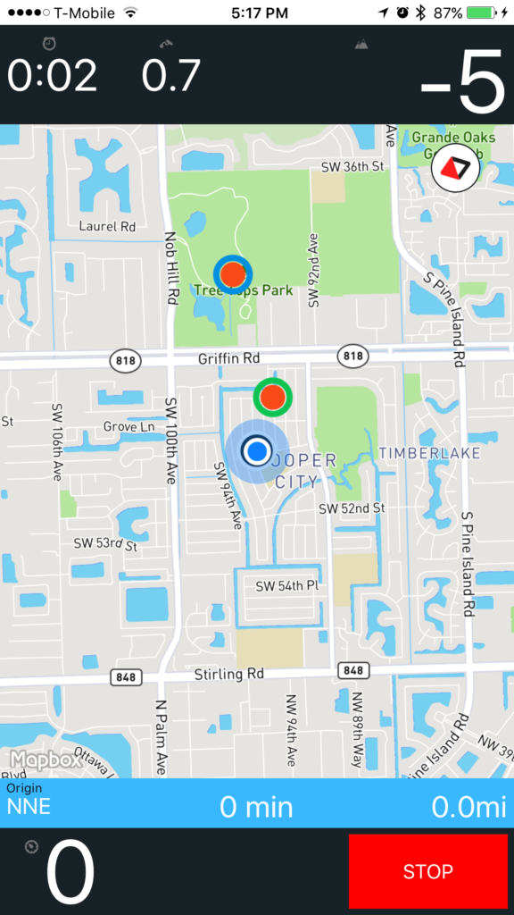
Street Map – shows streets, lakes, parks, etc in different colors.
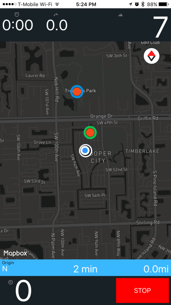
Dark Map – everything is dark besides the pilots markers.
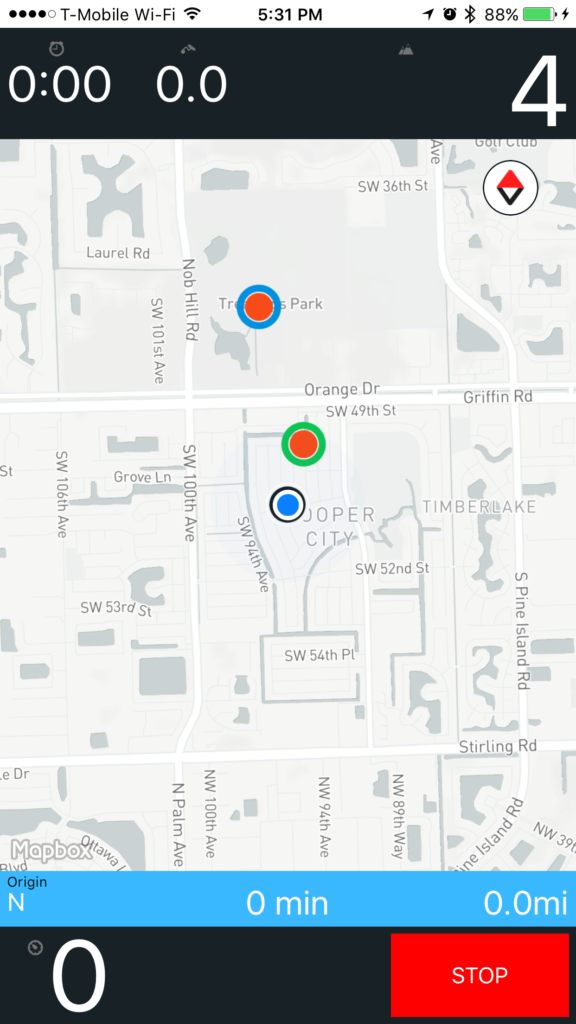
Light Map – everything is light besides the pilots markers.
Questions? Suggestions? Bugs?
[contact-form-7 id=”515″ title=”Contact form 1″]